Bomb craters (5) - 500kg bomb near Eastbourne
Posted: 10 July 2012 22:37
The five bomb craters I've described so far have all been found by fieldwork; a bomb report lead to my locating another feature on the Downs, again, near Eastbourne.
The fact that this crater is documented gives me some useful insights into the work of Home Office investigators as it allows me to compare their wartime measurements directly with my own survey data. This is an important point; has the data I've been gathering so far been wrong in some way?
Let's cut straight to the action. One evening in October 1943
23:25 hours: Enemy aircraft circled round area then dropped bomb, flying SE and left east of town on SE course. Visibility good, fine starlight night. One tenth cloud at 4,000ft. Wind west 5mph. Royal Observer Corps logged two red parachute flares off coast opposite Eastbourne 23:27. Air Raid Warnings: Purple - 23:13 Red - 23:16 White - 00:21.

The crater was recorded as 12ft across, 5ft deep and the bomb was identified as a 500kg.
The type of aircraft responsible was not identified.
Frustratingly, the report does not give a grid reference for the crater; it did, however, provide two reference points 1/4 mile away in different directions.
This caused me to chance upon the feature arrowed on Google Earth seen at right - it looks like a crater, but my reckoning actually placed the site in amongst some trees on a Downland slope.
How sheepish did I feel when, after half an hour of ferreting around in gorse bushes, I traipsed in desperation out into the open, only to find that the crater was the feature I had been looking at so disbelievingly in Google Earth! I do make it hard for myself sometimes...
This little episode was all forgotten once I had time to behold my discovery, as shown below - it is a very nice bomb crater! I'll continue my numbering sequence, making this crater 6.

I took a cross-section and generated the graphic below with an SC500 bomb:

I measured the crater as about 6.4m diameter (21 feet) and about 1 metre (3 feet) deep.
This is when I noticed the discrepancy between my data and that taken at the time - when this crater was measured fresh in 1943, it was 12ft across and 5ft deep!
The fact that the crater is shallower today is of no surprise, but it would appear that it has nearly doubled in size.

Look at my section again (right) and you can see the difference; the obvious conclusion is that the outer lip of the crater has experienced subsidence over the years.
This makes any attempt to measure undocumented craters (and thereby identify bomb size) even less likely, as a smaller crater might have enlarged over time into the size range normally seen for larger bombs. Add to this the myriad factors that govern crater size and the seemingly random nature of them and we are really only left with educated guesswork.
As I alluded to previously, however, it's more important to have identified this otherwise anonymous feature for posterity than to revel in the absolute forensic detail all the time - I still enjoy being 'first' on the scene 70 years after the event and uncovering the battlefield beneath your feet!

Coming up in Part 6: we'll be sizing up another documented bomb crater and see how a long-standing local mystery was solved!
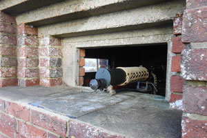
As the photo at right shows, we'll also be taking a brief trip below ground...
- Pete

Email:
Blog Latest
Bishopstone reveals its pillbox secrets
18 October 2021
Pillbox or Observation Post?
10 June 2020
Uncovering the hidden secrets of a pillbox
8 June 2019
Review of 2018
31 December 2018

Wartime Christmas in East Sussex (2)
24 December 2018
Jargon-buster
No terms to describe
This site is copyright © Peter Hibbs 2006 - 2026. All rights reserved.
Hibbs, Peter Bomb craters (5) - 500kg bomb near Eastbourne (2026) Available at: http://pillbox.org.uk/blog/216705/ Accessed: 11 July 2026
The information on this website is intended solely to describe the ongoing research activity of The Defence of East Sussex Project; it is not comprehensive or properly presented. It is therefore NOT suitable as a basis for producing derivative works or surveys!