Bomb craters (2) - Lewes
Posted: 19 June 2012 21:56
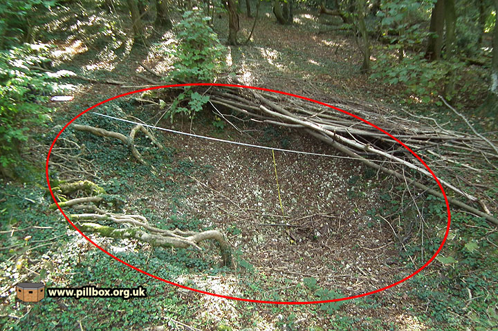
I ended the first part of this series with a photograph of what I think is one of a pair of bomb craters. In part two, we look at these features and discuss the evidence that convinces me as to what they are.
I have been unable to locate any bomb craters in the East Sussex Historic Environment Record and, although a handful are included in the National Monuments Record, these have seemingly been identified from 1940's aerial photos, as opposed to fieldwork.
The two craters we're looking at appeared on my radar back in 2009 when I stumbled upon them whilst recording a defended locality on the Downs in the Lewes area. I was excitedly following a trail of slit trenches on a wooded slope when I ventured five metres uphill and suddenly found myself on the lip of a crater.
I had no real idea as to what I was looking at; I had never before encountered a landscape feature anything like it. I took some basic dimensions, added it to my field sketch (simply labelled as "crater"), and promptly stumbled across a second one close by. I had wondered at the time if they were bomb craters, but thought it was too good to be true to find evidence of enemy action in amongst the trenches.
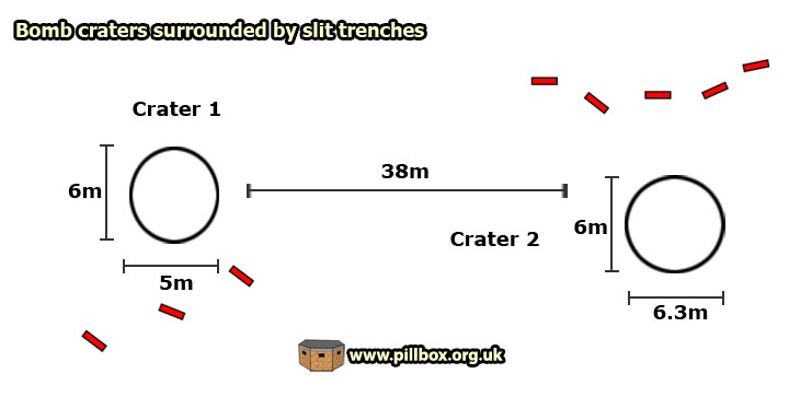
The diagram below shows the layout of part of the locality; note the close proximity of the slit trenches to the craters.
Crater 1
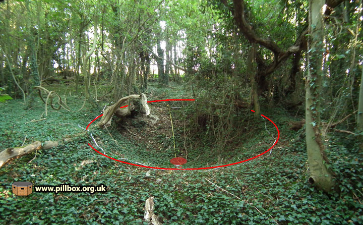
Crater 1 is shown in the following photographs, from different angles.
It measures 5 x 6 metres and is about 1m deep.
The photo at right is looking uphill, the red spot indicates the centre of the crater.
This photo is repeated from part 1 of this series, where you can see a full-size version.
Photo below: looking downhill in the opposite direction. The slit trench in the foreground is just 2 metres away from the crater.
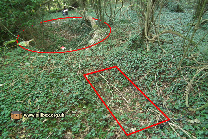
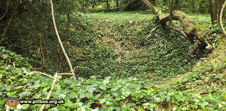
Photo below: looking downhill again, but a rare combination of natural light, camera angle and vegetation gives a good idea of the nature of these craters - they can be very difficult to photograph!
Crater 2
A quick look at crater 2 now; just one photo to give you an idea of its appearance before we examine it in greater detail.
This crater is the largest I've seen, measuring roughly 6 x 6.3m and about 1.8m deep.
Crater form
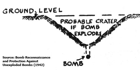
Both of these craters roughly follow the form illustrated at right; ie, relatively gentle concave depressions.
The immediate impression when seeing these craters first-hand is that they're very neat in their form, perhaps more saucer-shaped than the "V" in the diagram.
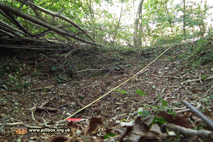
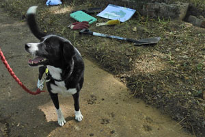
The photo below shows the sloping nature of the crater marked by a yellow tape measure; as the crater is in a hillside, the 'centre' (marked by my partially-hidden red clipboard), is seemingly offset towards the lower end. Note how pronounced the lip is.
What else could these craters be?
So far I've based my assumptions on wartime manuals and fieldwork. However, I always consider alternative explanations and one that springs to mind are marl pits.
Marl is a mixture of lime and clay used historically by farmers as a fertilizer and to reduce soil acidity. Is is possible that these craters are in fact marl excavation pits?
I've thought long and hard about this and I'm sticking with my bomb crater theory; the shape and form of both of these craters is too 'perfect' to have been manually excavated - they're too neat and consistent!
The craters are not marked on old maps and an archaeological excavation carried out here some years ago crucially lead to the slit trenches entering the archaeological record, but these craters are seemingly not recorded, either as marl pits or, indeed, anything else.
Key evidence does lie in the shape - there's too much similarity between both of these craters and others elsewhere that will be examined later on in this series.
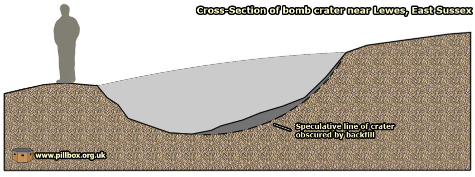
I took the cross-section below; the measured edges are not clean as there is an amount of loose material in the crater and the lip of both craters has been distorted by tree growth.
Documentary evidence?
I have found a report in a war diary of an attack on Lewes, but I'm not convinced it describes the birth of our craters. A key point is that the slit trenches appear to have been sited to avoid the craters, making me think the craters came first. Of course, it is possible that some trenches were destroyed, but one trench just 2m away from crater no.1 shows no more sign of distress than any other backfilled trench I've seen on the Downs. I can date these trenches to within about three weeks and the incident report is after this date. I therefore provide the extract below more as an indication of how randomly bomb craters could occur in isolated spots:
Warning of raid 82H given as 1 aircraft at 4,600ft at 18:02 hours. Aircraft was plotted making landfall at 18:16 hrs and flying inland to Lewes where it circled anti-clockwise. Approaching the town at cloud base level it was engaged by LAA (Light Anti-Aircraft) positions, between 800/1,000ft causing enemy aircraft to drop its bombs early. Two high explosive (HE) bombs and 8 firepots fell. One hit was observed. Aircraft took violent evasive action upon being engaged.
But what of the possible bomb sizes that caused these craters? We will look at this confusing and contradictory aspect as well as another two craters in part 3!
- Pete

Email:
Blog Latest
Bishopstone reveals its pillbox secrets
18 October 2021
Pillbox or Observation Post?
10 June 2020
Uncovering the hidden secrets of a pillbox
8 June 2019
Review of 2018
31 December 2018

Wartime Christmas in East Sussex (2)
24 December 2018
Jargon-buster
Defended locality
An area defended by a force (e.g. a platoon) occupying a series of defence works, normally within a barbed wire perimeter. Localities were designed for all-round defence and usually fitted in with a coordinated scheme of neighbouring localities.
Slit trench
Small, narrow trench designed to provide protection against shrapnel and other battlefield hazards. Technically distinct from a weapon pit (which was intended soley as a defensive position) slit trenches were also used as defence works.
War diary
A record of events kept by all units from the point of mobilisation. A diary's contents vary enormously from unit to unit; some give detailed entries by the hour on a daily basis while others merely summarise events on a weekly/monthly basis.
This site is copyright © Peter Hibbs 2006 - 2024. All rights reserved.
Hibbs, Peter Bomb craters (2) - Lewes (2024) Available at: http://pillbox.org.uk/blog/216702/ Accessed: 27 July 2024
The information on this website is intended solely to describe the ongoing research activity of The Defence of East Sussex Project; it is not comprehensive or properly presented. It is therefore NOT suitable as a basis for producing derivative works or surveys!