Cat Scratch Fever: anti-landing trenches
Posted: 26 February 2011 08:31
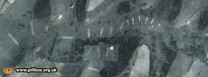
You can see why an archaeologist friend of mine refers to them as cat scratches. Luftwaffe aerial photographs show the locations of trenches dug on the Downs to prevent aircraft landing. Fieldwork reveals surviving evidence.
One of the problems facing the army in East Sussex was the vast tracts of open land that might be suitable for the Germans to land aircraft or gliders on, and to counter this, anti-landing obstacles were developed. These included littering open fields with haystacks, old vehicles or poles with heavy-duty cable stretched between them. Another favourite method of obstruction was trenching.
Aerial Photographs
The Luftwaffe photograph below is a vertical view of an area of the Downs; you can see trenches everywhere.
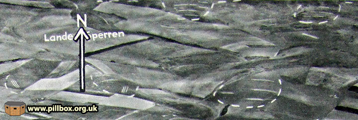
Below is an oblique view with groups of trenches circled by German intelligence analysts. Lande Sperren translates as "Land obstructions". I had previously questioned whether these scars in the landscape had been of wartime origin, but these two photographs really clinch it for me as I can't see what else they could have been.
Fieldwork
My next step, of course, was to go into the field and try and locate some of the trenches.
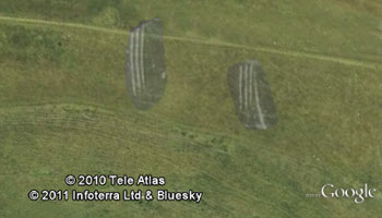
Having overlaid one photo on Google Earth and then Photoshopped and transferred just the trenches on top of the modern view, I got the image at right and had something to work with.
Some lines are actually visible in Google Earth, but only identifiable once you've overlaid the WW2 photo.
It was at this point that a bell rang in my mind; I had seen some annoying shallow ditches cut across some areas when I'd been looking for slit trenches. I call them 'annoying' as whenever I saw part of one amongst long grass, I would initially think it was a slit trench, only to have my hopes dashed by a long shallow gully. I had no real idea what these gullies were and so assumed they were some sort of drainage/agricultural feature or perhaps prehistoric.
The graphic below shows a cross-section of the Downs; we can see that the obvious place to attempt a landing is on the flattest area on the very top.

Finding the evidence
Having arrived in the first area I was investigating, I located what I believed to be the first three sets of 'scratches.' The problem was, I could only find evidence of one trench in each set, not the three scars that the aerial photographs show.
It wasn't until I was looking at the third set that I stumbled upon the missing two 'trenches' in each set of three. The central feature was a trench, but the outer features were actually spoil heaps - they just appear as white scars on aerial photographs.
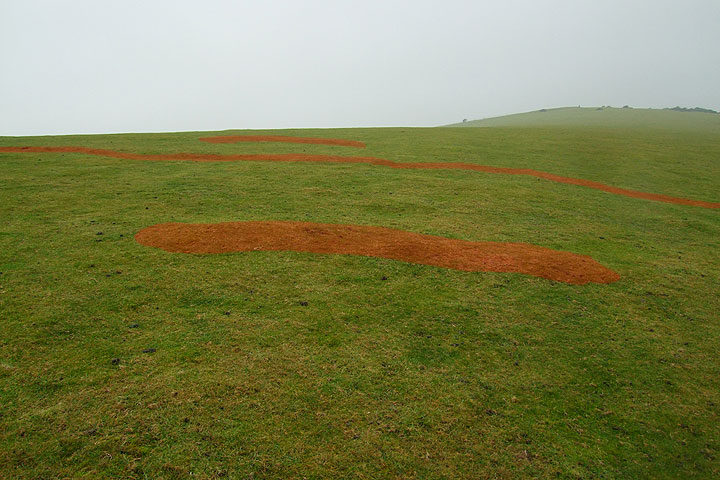
The photograph below shows the trench and remains of spoil heaps at one location. The spoils heaps are 6-7m away from the trench itself. This perhaps indicates the use of mechanical excavators to dig the trenches, as men digging in chalk (a back-breaking job) are not going to walk a short distance before dumping each spadeful of spoil, given the difficulty and urgency of the task. The uniform distance of the spoil from the trench on either side probably results from the swing and reach of the excavator.
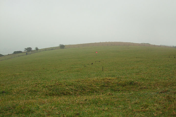
Another discovery in the vicinity was a small locality of slit trenches, one of which is shown below. This trench looks like a 1940 defence work, but whether it was sited with the anti-landing trench in mind is unclear. The red mark is my clipboard in the anti-landing trench, 80m away.
A second trip to a different area revealed a whole host of trenches. Again, armed with aerial photo overlays, a walk along the Downs yielded the correct number and orientation of these features and in the expected locations.
The photo below shows a trench running across the centre; again, a pair of isolated slit trenches stood distant guard over it.
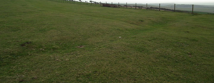
Another reason I failed to attach any significance to these gullies was the fact that in almost every case, they suddenly terminate at a fence line or other field boundary. The reason for this is now obvious; the portion of trench in agricultural land was more diligently backfilled and the evidence ploughed out.
A quick excursion into the middle of a field to try and locate another trench perpendicular to the one seen above revealed absolutely no evidence, despite GPS telling me I was in the right place. This means that many of the trenches for which I have a location from the AP overlay will probably not be identifiable on the ground.
However, the unploughed areas were turning up evidence thick and fast. Every so often, a gully suddenly sprang from the fence and went racing off into shallow oblivion amongst the long grass. Eight trenches duly appeared in the right pattern, orientation and places indicated on my overlay.
A slight problem did arise in that I was also finding one or two similar features that I was sure were not military. In one case, a gully ran from a cluster of tumuli a few metres to the very edge of a steep slope; a pointless and uneccessary location for an anti-landing trench and not visible on the APs. I'm still uncertain as to what it might be though. Some post-war activity has gone on in laying water lines to cattle troughs and reservoirs and power lines to remote farms and mobile phone masts, but I'm not convinced these explain some of these features; they may well have been drains or perhaps prehistoric.

Another unusual formation is seen at right; not cat scratches, but seemingly a trench with circular features flanking it on both sides.
A conversation over a few beers with some archaeologists and historians identified these circular features simply as individual spoil heaps.
The absolute decider was an aerial photograph sent to me (thanks Justin!) of modern archaeological evaluation trenches dug by machine. These show the two types of spoil heaps (continuous and individual) and they match the wartime features exactly. Cross ridge dykes were also eliminated from the cat scratch equation.
Uncovering a defensive system
In the last location I sought, I did find a trench running from some tumuli, but in a way that made sense. The ancient earthworks provided an extension of the trench's obstructive power.
This trench was also of interest in that it terminated right in the middle of a defended locality that I had not previously been aware of.
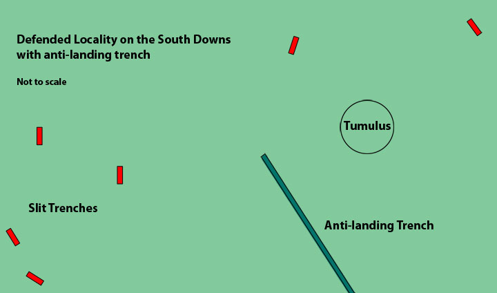
The locality itself comprised at least 12 standard slit trenches (as opposed to just two or three near other anti-landing trenches) and this has awakened a fresh set of questions in my mind, most of which I cannot answer from the known documents as yet.
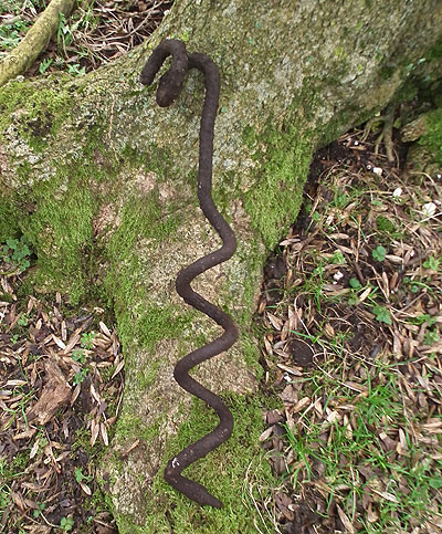
An interesting find here was a silent picket, seen in the photo at right.
These shorter corkscrews were used as anchor points for barbed wire obstacles; in this case useful supporting evidence for identifying this as a permanent, wired-in defended locality as opposed to a few random trenches dug as part of a training exercise.
Documents
But what documentary evidence do we actually have? One or two brief mentions of trenching in fields (not on the Downs) appear in some of the 1940 war diaries but not much else specific to East Sussex.
A trip to the National Archives a few weeks back did throw up some clues on general policy though:
A trench system of chessboard type is recommended....The trench should be continuous, the soil being thrown up in mounds on either side. If the land is sloping or already drained, the trench system need not necessarily be in the form of squares and the trenches can be sited so that they can be used as drains...
This one extract provides a lot of useful evidence; the Downs can be excluded from conforming to a continuous grid of trenches. Whether they were considered as drains too is questionable due to the porosity of the chalk.
The prescribed spoil heaps on either side of the trench fit in with the cat scratch appearance, and the fieldwork evidence from one area presented above.
Conclusion
This has been a very useful and informative exercise. The aerial photographs have indicated the locations of at least 70 anti-landing obstacles on the Downs, 15 of which I have so far found evidence of. Even if I find no further evidence, I have enough data to add the 70 trenches into the Concrete Evidence database with reasonably accurate grid references.
Locating these anti-landing trenches has also brought me to previously unvisited locations to discover a total of nearly 50 unrecorded slit trenches and earthworks and a greater insight to associated features and activity.
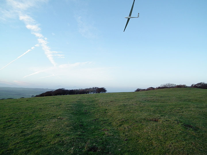
I couldn't resist including the photo above. It was taken looking along the anti-landing trench in the diagram above, just as a radio-controlled model glider flew overhead. Needless to say, it had no trouble in landing...
- Pete

Email:
Blog Latest
Bishopstone reveals its pillbox secrets
18 October 2021
Pillbox or Observation Post?
10 June 2020
Uncovering the hidden secrets of a pillbox
8 June 2019
Review of 2018
31 December 2018

Wartime Christmas in East Sussex (2)
24 December 2018
Jargon-buster
Defended locality
An area defended by a force (e.g. a platoon) occupying a series of defence works, normally within a barbed wire perimeter. Localities were designed for all-round defence and usually fitted in with a coordinated scheme of neighbouring localities.
Silent picket
A barbed wire post made of iron with a corkscrew end for easy and silent insertion into the ground. Made in two lengths, the long type was to support coils of barbed wire while a short version with a single loop was used as an anchor point for large entanglements. Silent pickets can still ocasionally be found in situ in East Sussex.
Slit trench
Small, narrow trench designed to provide protection against shrapnel and other battlefield hazards. Technically distinct from a weapon pit (which was intended soley as a defensive position) slit trenches were also used as defence works.
This site is copyright © Peter Hibbs 2006 - 2024. All rights reserved.
Hibbs, Peter Cat Scratch Fever: anti-landing trenches (2024) Available at: http://pillbox.org.uk/blog/216681/ Accessed: 27 July 2024
The information on this website is intended solely to describe the ongoing research activity of The Defence of East Sussex Project; it is not comprehensive or properly presented. It is therefore NOT suitable as a basis for producing derivative works or surveys!